Geographic Information System
Environmental Monitoring
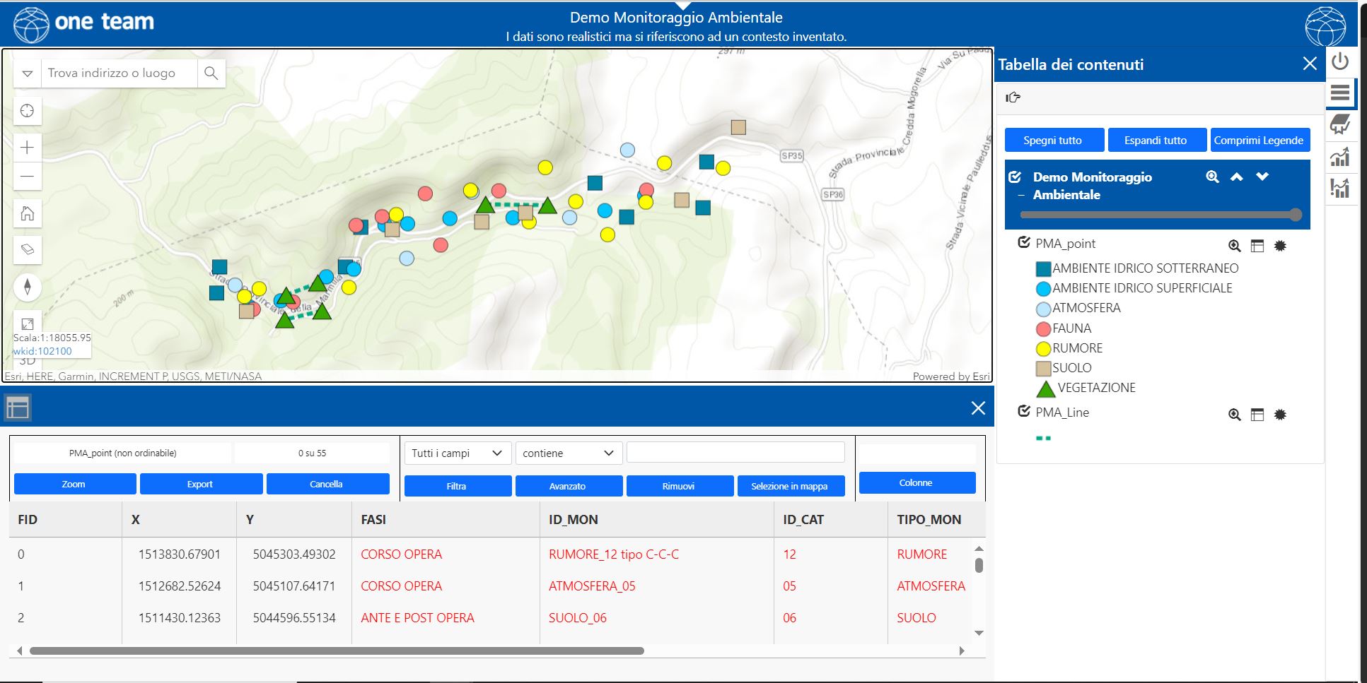
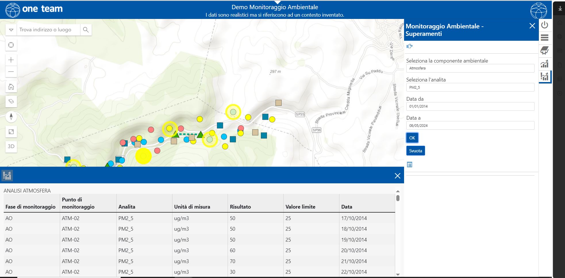
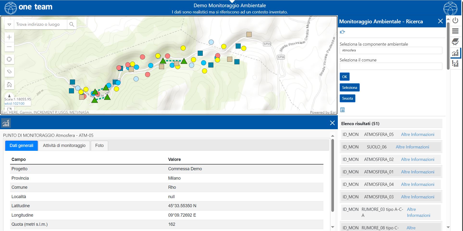
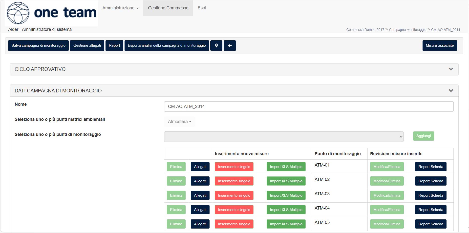
One Team offers solutions for environmental monitoring, both desktop and mobile, to manage data derived from survey (?) campaigns (temporal series of samples for the different environmental matrices) and perform spatial analysis for the environmental control linked to works or sites.
These solutions cater for both companies in the field and controlling authorities.
The Environmental Monitoring Module is available for both Portal and ArcGIS Online.
The environmental monitoring module by One Team, Geomaster, provides a cartographic interface ready to use and a parametric management (?) for the monitoring of major works (activities of environmental control of construction sites, from the ante operam phases to the post operam ones).
Using the ArcFalda application, it is possible to gather and represent data derived from monitoring campaigns, especially tied to the terrain and (acquifer or stratum?), for environmental characterization plans.